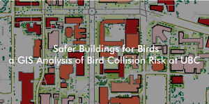
Final Project – Safer Buildings for Birds: a GIS Analysis

Buildings are the main anthropogenic cause of death for birds in cities, with approximately 16 to 42 million deaths in Canada each year, and around 10,000 deaths at UBC. To investigate this issue as a final project in my Advanced Issues in GIS class, I created a model to identify core institutional buildings of high bird collision risk at UBC. The project aims to recommend UBC operational staff where to target bird friendly design retrofits.


Advanced GIS: Potential Habitat Analysis for Spiranthes diluvialis

This week, I have been tasked to identify and produce a report on a rare plant species, Spiranthes diluvialis, to help a hypothetical botanist with her field work in the southern Okanagan. Using BC TRIM data, I create a digital elevation model and then use a multi-criteria evaluation methodology to map out ~700 hectares of potential habitat for the botanist to research.


Advanced GIS: Least-Cost Pathway for Marijuana Greenhouse

It’s been about over a year since I was first introduced to GIS, and I’m back to take GEOB 370 Advanced Issues in GIScience! In this lab assignment, I create a least cost path analysis for a hypothetical new marijuana greenhouse in Surrey and Langley, BC.


A thematic map of Oregon Spotted Frog Population and Recovery Programs in BC 1998-2010 showing populations of frogs in their habitats

Final Project – Oregon Spotted Frog Recovery in BC

For the final project of my GEOB 372- Introduction to Cartography course, we were tasked to make a thematic map on any issue we were interested in. As a volunteer for educational programs at the Vancouver Aquarium, I decided to use my cartography skills to make an educational proportional symbol map that would summarize the current state of Oregon Spotted Frog populations and recovery programs in BC from 1998-2010.